About i-Boating:Persian Gulf&Red Sea
GPS Marine Charts App offers access to charts covering Arabian/Persian Gulf & Red Sea (incl. Oman, United Arab Emirates, Iran and Qatar). Only marine GPS app to have route assistance with Voice Prompts for marine...
GPS Marine Charts App offers access to charts covering Arabian/Persian Gulf & Red Sea (incl. Oman, United Arab Emirates, Iran and Qatar). Only marine GPS app to have route assistance with Voice Prompts for marine navigation. It has route manager to create new boating routes or import existing GPX/KML routes. It supports Nautical Charts course up orientation.
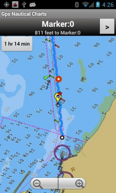
► Voice Prompts for marine navigation (requires GPS )
-prompts when approaching a boating route marker
-Continous distance and ETA updates
-Alerts when sailing/boating off route
-Alerts when boating in wrong direction
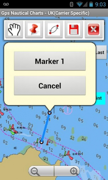
►Route Editing/Creation
-Create routes from scratch
-Edit existing GPX/KML routes.
-Add custom description to any route point.
-Drop markers along route.
► Advanced NMEA Instrumentation
√AIS over TCP/UDP
√Wind speed, direction, temperature, depth, GPS over NMEA
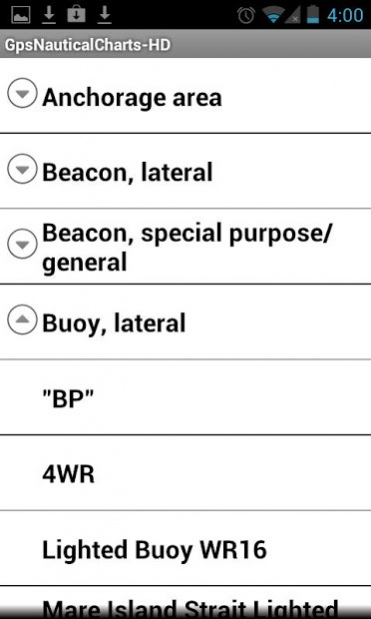
► Offline charts for Persian/Arabian Gulf, Red Sea and Gulf of Aden.
►Seamless chart quilting of marine charts
► Persian/Arabian Gulf
-Iran & Qatar: Chiru, Khafji & more.
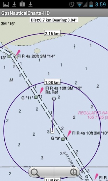
►Distance Bearing tool
►Oman
-Mirbat, Muscat, Sohar, Hormuz & more.
►Create custom way points
- Using GPS
-Select point on map
-Manually enter latitude & longitude coordinates
► Red Sea and Gulf of Aden
-Melita Bay, Strait of Tiran, Yemen, Zeit & more
► United Arab Emirates
- Al Jeer Port, Khalifa Port & more
*Pan/Zoom/My Location
* Record Marine GPS tracks
* View tracks overlay
* Live track animation
* Track analytics/stats
► Export GPX tracks.
-Export to SDCard
-Share GPX trakcs with friends/View on Google earth.
►Auto Follow Mode (Course up)
-Continuously updates boat's location on chart
- Adjustable update frequency
Previous Versions
Here you can find the changelog of i-Boating:Persian Gulf&Red Sea since it was posted on our website on 2016-11-06 00:29:35.
The latest version is 102.0 and it was updated on 2024-03-28 21:09:02. See below the changes in each version.
i-Boating:Persian Gulf&Red Sea version 102.0
Updated At: 2016-12-19
Changes: ► Advanced NMEA Instrumentation
√AIS over TCP/UDP
√Wind speed, direction, temperature, depth, GPS over NMEA
► ETA/Fuel estimation calculator
► Switch background maps to satellite imagery or street maps.
i-Boating:Persian Gulf&Red Sea version 76.0
Updated At: 2016-04-11
Changes: ► Advanced NMEA Instrumentation,√AIS over TCP/UDP,√Wind speed, direction, temperature, depth, GPS over NMEA
Disclaimer
Official Google Play Link
We do not host i-Boating:Persian Gulf&Red Sea on our servers. We did not scan it for viruses, adware, spyware or other type of malware. This app is hosted by Google and passed their terms and conditions to be listed there. We recommend caution when installing it.
The Google Play link for i-Boating:Persian Gulf&Red Sea is provided to you by apps112.com without any warranties, representations or guarantees of any kind, so access it at your own risk.
If you have questions regarding this particular app contact the publisher directly. For questions about the functionalities of apps112.com contact us.